- 238
- Episodes
- Weekly
- Cadence
- 2024
- First episode
About Derecho
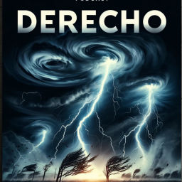
Welcome to "Derecho," the podcast where we delve deep into the awe-inspiring and often destructive weather phenomenon known as a derecho. Join us as we explore the science behind these powerful storms, their impact on communities, and the thrilling stories of those who have experienced them firsthand. Whether you're a weather enthusiast or just curious about the forces of nature, "Derecho" offers insightful discussions with meteorologists, climate scientists, and storm chasers who bring you closer to the heart of these incredible weather events. Tune in to understand the dynamics of derechos and their significance in the world of extreme weather. This content was created in partnership and with the help of Artificial Intelligence AI.
- Publisher
- Inception Point AI
- Category
- science
- Language
- en
- Explicit
- No
- First episode
- 7 Jun 2024
- Latest episode
- 20 Jun 2026
Latest episodes
238 episodes in the feed.
20 Jun 2026
# Powerful Straight-Line Windstorm Derails Trains Across Illinois
A fast-moving, destructive windstorm blasted across parts of the central United States this week, delivering a textbook example of how close some severe thunderstorm complexes can come to derecho status. While the National Weather Service has not formally labeled the event a derecho as of this recording, the storm’s structure, longevity, and damage footprint are precisely the kind of pattern forecasters watch when they talk about widespread, long-lived windstorms. According to Fox Weather, severe thunderstorms erupted over western Illinois and neighboring areas and quickly organized into a bow-shaped line, a radar signature often associated with powerful straight-line wind events. Forecasters reported that between about 8:13 and 8:31 a.m. in Warren County, Illinois, hurricane-force straight-line wind gusts estimated at 80 to 100 miles per hour tore through the region, derailing multiple double-stack freight train cars near the community of Ormonde. Drone and ground video shared in the Fox Weather report showed long rows of rail cars toppled and scattered into adjacent fields, a scene that many locals initially assumed had to be the aftermath of a tornado. National Weather Service survey teams, however, found no evidence of a tornado circulation in the damage pattern. Instead, meteorologists concluded that the destruction was caused entirely by straight-line winds, aligned with the forward motion of the convective line. That kind of uniform, “all one direction” damage is a hallmark of derecho-style events, which are driven by powerful downdrafts and rear-inflow jets inside squall lines rather than the rotating updrafts that define tornadoes. Social media posts from storm chasers and local meteorologists across Illinois and the broader Midwest this week underscored how atypical the winds were. Several mentioned that trees were snapped or uprooted over a broad swath, metal structures were peeled apart, and power poles were knocked down in multiple counties, not just at isolated points. Utilities reported tens of thousands of customers losing electricity as the storms surged east, with outage maps briefly showing large contiguous zones of blacked-out communities. While many of those customers saw service restored within a day, some rural pockets faced longer waits as crews navigated blocked roads and tangled lines. Researchers have been warning that these kinds of intense straight-line wind events may be getting stronger. A post shared by meteorologist Brandon Butcher highlighted recent work indicating that thunderstorm straight-line wind speeds in the central United States have intensified by roughly 7 percent per degree Fahrenheit of warming since 1980. That line of research suggests that when the atmosphere loads up with heat and moisture, the potential energy available for violent downdrafts and cold pools increases, making high-end wind events more likely and more damaging. Outlooks from severe weather analysts this week, including video briefings on Severe Weather HQ’s YouTube channel, emphasized that the broader pattern over the Plains and Midwest remains favorable for more organized thunderstorm complexes. A level 3 out of 5 severe risk was posted for parts of Colorado, Kansas, and Nebraska in the short term, with damaging winds highlighted as the primary threat. That is the same general corridor that often seeds the kind of nocturnal mesoscale convective systems that can evolve into derechos as they race east toward the Mississippi Valley and Ohio Valley overnight. Regional meteorologists on platforms like Instagram and Facebook have been reminding followers that June and July are peak season for these high-velocity windstorms, especially from the central Plains into the Corn Belt and Great Lakes. One Instagram forecast account focused on the New York–New Jersey–Pennsylvania region noted that the large-scale pattern this summer favors repeated bouts of strong, fast-moving lines capable of flattening crops and knocking out power on a regional scale. That context matters, because events like the Illinois train derailment are not one-off curiosities; they are part of a broader severe-weather environment primed for more long-lived windstorms. For listeners in the central and eastern United States, the key takeaway from this week’s destructive Illinois windstorm is that not every scene of toppled trains and shredded trees is the work of a tornado. When a bowing line of storms shows up on radar, and watches highlight hurricane-force gusts, the threat from straight-line winds can rival or exceed that of many tornadoes, especially in terms of geographic coverage and infrastructure impact. Paying attention to severe thunderstorm warnings, not just tornado warnings, is essential during these high-end events. Thank you for tuning in, and come back next week for more. This has been a Quiet Please production, and for me check out Quiet Please Dot A I. Some great Deals https://amzn.to/49SJ3Qs For more check out http://www.quietplease.ai
18 Jun 2026
# Powerful Derecho Sweeps Midwest with 70+ mph Winds, Widespread Damage
Listeners, a powerful derecho hammered parts of the Midwest this week, delivering a textbook example of a long-lived, fast-moving, and destructive windstorm riding along a line of thunderstorms. According to the National Weather Service office in Des Moines, an intense squall line raced across Iowa in the early morning hours of June 17, producing a broad swath of 60 to over 70 mile-per-hour winds from northwest to southeast across the state. They report widespread tree damage, snapped power poles, and damage to homes and outbuildings, the kind of structural impact that pushes an event toward derecho territory when combined with its size and duration over multiple counties. Social media filled in the ground truth in real time. MyRadar’s severe weather team posted that a severe weather outbreak was underway in the Midwest, highlighting destructive morning storms and warning that multiple rounds of severe thunderstorms would follow as the system pushed east. FOX Weather meteorologist Ian Oliver analyzed what he called a rare Level 4 out of 5 severe risk across the central United States, emphasizing the threat for widespread damaging winds along the evolving line of storms. On Instagram, storm trackers shared clips from Iowa describing “dangerous storms” with 80 mile-per-hour gusts and hail, urging anyone in the path of the line to seek shelter immediately. Farther east, outlets such as GV Wire reported that this same broader system produced a derecho back on June 10, then re-intensified as it moved across the Plains and Midwest, setting the stage for the June 17 blast of wind across Iowa, Illinois, and surrounding states. GV Wire quoted Storm Prediction Center meteorologist Andrew Lyons warning of a high probability of long-lasting, highly organized thunderstorms capable of producing winds over 75 miles per hour, particularly across Illinois and Indiana. That guidance proved accurate as the maturing convective system pushed east, with the Washington Post’s weather team describing a “potentially intense outbreak” featuring destructive gusts, large hail, and embedded tornadoes from the Plains into the Midwest and Northeast. Local television stations showed the human impact. KCRG-TV9 in eastern Iowa shared viewer video from North Liberty of large trees snapped or uprooted after a derecho tore through much of Iowa and Illinois, with reports of wind gusts exceeding 100 miles per hour in northern Illinois earlier in the week as the broader pattern of severe weather unfolded. Posts from Illinois meteorologists on Facebook noted “destructive 75–80 mph wind gusts” as round one of storms blew through, using the word derecho explicitly as they warned their audiences about the evolving wind threat. On Instagram, climate-focused accounts pointed out that Illinois is enduring a summer defined by repeated severe storms, tornadoes, and derechos, tying this pattern to the ongoing El Niño and its influence on jet stream position and moisture availability in the central United States. Another reel summarizing the past several days of severe weather noted that since June 9, the parent storm system has generated nearly 1,200 severe reports across the country, including dozens of tornadoes and many instances of damaging straight-line winds, with the June 17 Iowa windstorm one of the standout events. For listeners, the key takeaway from this week’s derecho episode is how quickly a seemingly distant line of storms can organize into a destructive wind machine, racing hundreds of miles overnight. When the Storm Prediction Center, local National Weather Service offices, and outlets like FOX Weather and the Washington Post begin highlighting the risk of widespread 70 to 80 mile-per-hour gusts along a large, continuous line, it is time to prepare for power outages, falling trees, and flying debris over a very broad area. Thanks for tuning in, and come back next week for more. This has been a Quiet Please production, and for more from me check out QuietPlease dot A I. Some great Deals https://amzn.to/49SJ3Qs For more check out http://www.quietplease.ai
16 Jun 2026
# Massive Derecho Brings Hurricane-Force Winds, Widespread Devastation Across Midwest
A massive, fast-moving derecho tore across parts of the Midwest in the last few days, bringing hurricane-force wind gusts, downed power lines, and major disruption to daily life across several states in the central United States. According to AccuWeather and the Associated Press, the event was powerful enough to knock out electricity to well over 400,000 customers at its peak, with the heaviest impacts focused in Illinois, Wisconsin, and Missouri as the bow-shaped line of storms rocketed eastward across the region. AOL News reports that this derecho developed from a cluster of severe thunderstorms that rapidly organized into a classic bow echo, a radar signature strongly associated with destructive straight-line winds. As the system matured, embedded downbursts and rear-inflow jets pushed wind gusts into the 70 to 90 mile-per-hour range in some communities, strong enough to snap large tree trunks, peel roofing off homes, and overturn semi-trailers on interstates. Local TV stations in Chicago and Milwaukee shared images of entire neighborhoods blanketed in fallen trees, blocking residential streets and damaging vehicles. The National Weather Service offices serving northern Illinois and southern Wisconsin noted that the wind damage was unusually widespread and consistent over hundreds of miles, one of the hallmark traits of a derecho as defined by the National Weather Service’s Storm Prediction Center. Forecasters pointed out that this system maintained severe or near-severe wind intensity for many hours, racing from the Plains into the Great Lakes region with only gradual weakening late at night. In some locations, automated weather stations captured wind gusts comparable to a Category 1 hurricane, but the damage pattern was linear rather than tornadic. Utility companies across the region told outlets like the Chicago Tribune and Milwaukee Journal Sentinel that fully restoring power will take several days, given the sheer number of downed distribution lines and damaged poles. Crews are working 16-hour shifts, but access remains a challenge in neighborhoods where streets are still choked with large limbs and debris. Emergency managers in several counties opened cooling centers, concerned that lingering heat and humidity could pose health risks for those without air conditioning. Some small towns also issued boil-water advisories after pump stations lost power during the height of the storm. Social media has been full of on-the-ground perspectives. Storm chasers and local meteorologists on platforms like Facebook and X shared time-lapse videos showing the ominous “shelf cloud” racing toward communities ahead of the wind core, followed by near-whiteout conditions of wind-driven rain and blowing debris. Indiana Weather Online, commenting on the broader pattern, noted that the Midwest and Northern Plains have seen multiple derecho-producing setups already this season, highlighting just how volatile the atmosphere has been in early summer. For listeners in the central and eastern United States, forecasters at the National Weather Service and private outlets like The Weather Channel emphasize staying weather-aware whenever a severe thunderstorm watch is issued, especially on days when storms are expected to form into long lines. Even without tornadoes, derechos can generate wind damage on par with some landfalling tropical systems, and they often strike in the evening or overnight when people are less alert. Thank you for tuning in, and come back next week for more. This has been a Quiet Please production, and for more from me check out QuietPlease dot A I. Some great Deals https://amzn.to/49SJ3Qs For more check out http://www.quietplease.ai
Podcast Authority Score: 47 / 100
A composite of feed quality, social presence, YouTube performance and engagement. Read the methodology.
- Quality
- 94
- Social presence
- 0
- YouTube
- 0
- Engagement
- 0
Contact Derecho
- Guest appearances
- Does not typically book guests
Based on episode analysis; this does not confirm that the show is currently accepting guests.
Host of Derecho?
Claim your podcast to manage its listing and keep your show details accurate.
Pod Engine is an independent podcast discovery and analytics service and is not affiliated with or endorsed by this podcast. Artwork and show content belong to their owners. Full legal notice.
Explore this show
Podcast research with Pod Engine